Serpa

RATE CENTER

1 1 1 1 1 1 1 1 1 1 Rating 3.41 (16 Votes)

238 KM OF TRAILS
4 LEVELS OF DIFFICULTY
4 ROUTES

Serpa is located in Baixo Alentejo, on an elevation on the left bank of the river Guadiana, being the seat of one of the largest municipalities in the country.

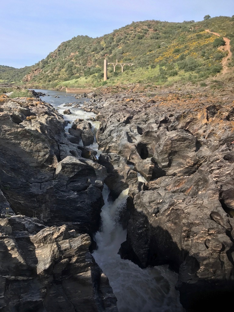
The landscape is one of the major attractions of the municipality, where the vineyards, the olive groves and the "montados" are evident. Serpa is part of the Guadiana Valley Natural Park, where Pulo do Lobo provides an incredible view over the great southern river. The diversity of the flora is combined with the richness of the fauna, with the black stork, the eagle owl and the ambassadors of the county: the Iberian lynx and the Bonelli's eagle.

Inhabited since ancient times, the territory is rich in archaeological heritage, knowing about eight hundred archaeological places. The great Roman and Arab influence in the municipality is still evident in the built patrimony, namely in the Serpa Castle, the aqueduct, noria, the churches and hermitages.

In the traditional, very rich and diversified gastronomy, pork, lamb, hunting food and bread have a greater presence, highlighting local quality products such as Serpa cheese, wine and olive oil. The Cante Alentejano - Immaterial Cultural Patrimony of Humanity of UNESCO since 2014, can be appreciated in the local festivities, in the open rehearsals of the various choral groups all over the municipality, and spontaneously in the various taverns.

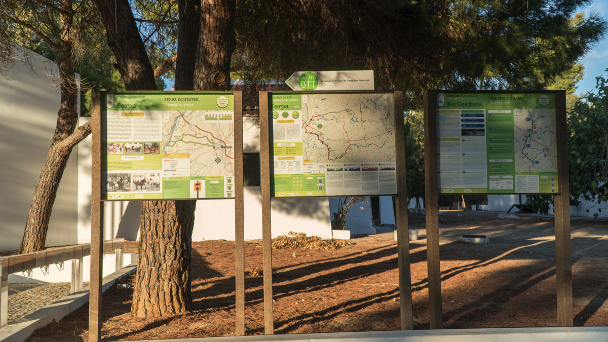
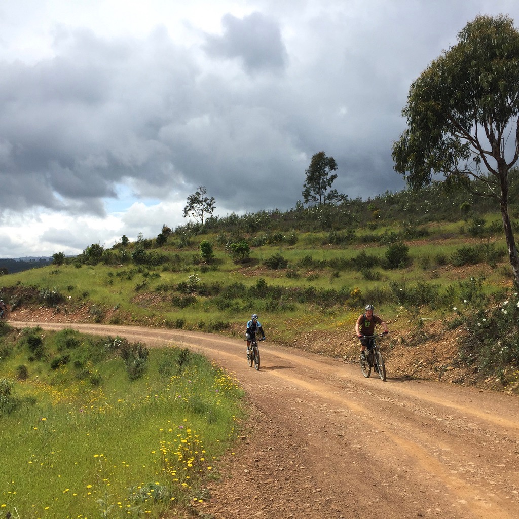
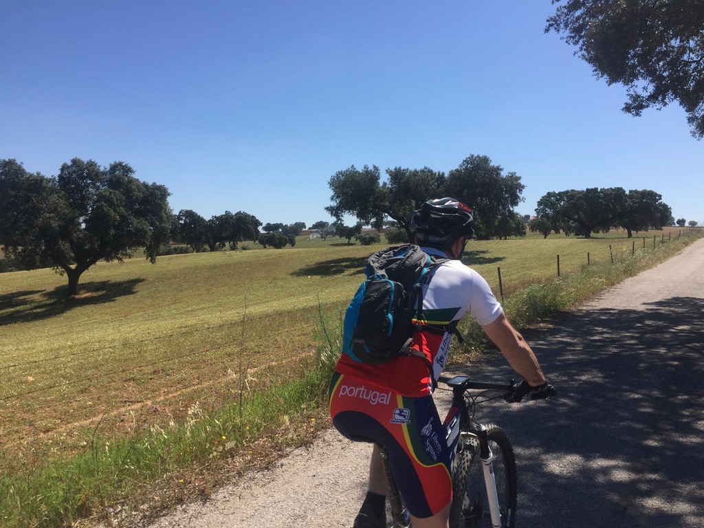
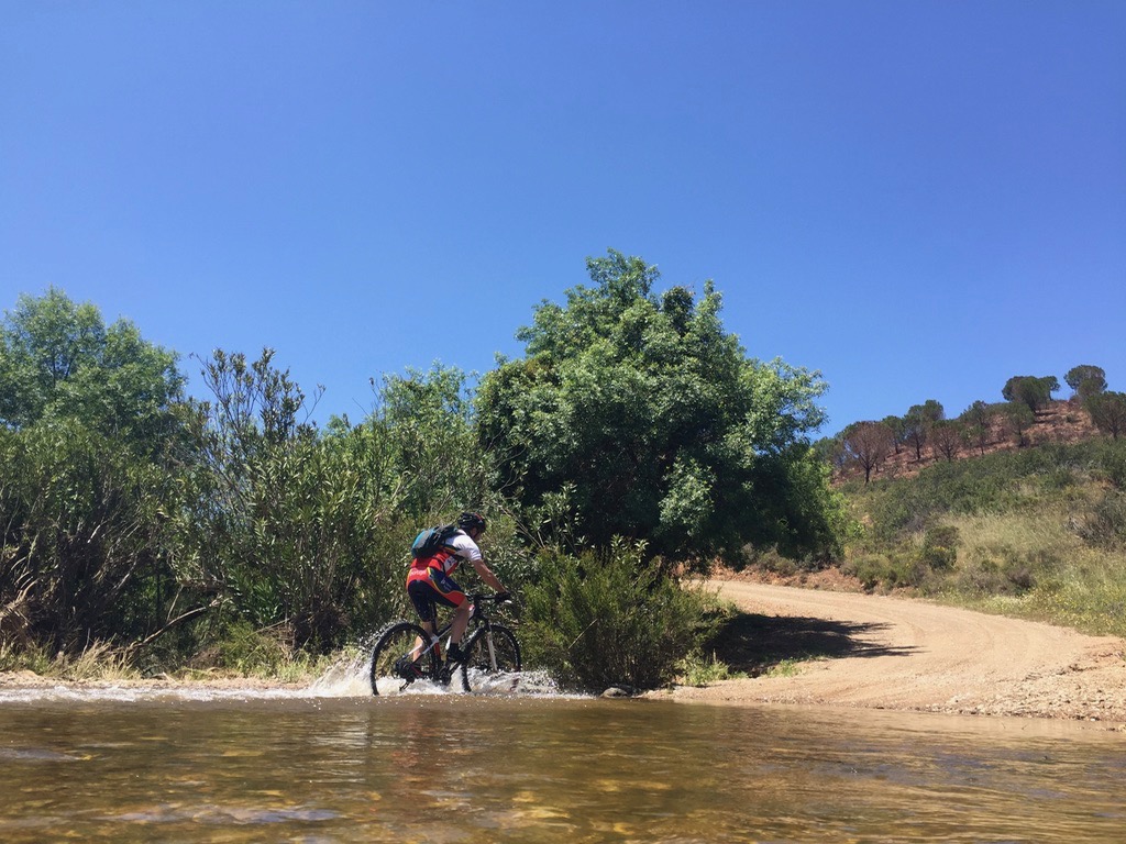
The Serpa council has great characteristics for the practice of mountain biking, which are highly referenced by practitioners who come to this county to ride their bicycles. The implementation of the Mountain Bike Center aims to attract new audiences to the region, boosting the county for outdoor activities and nature sports, boosting tourism activity and the local economy. The routes created admit several connections and combinations that allow to reach all the parishes of the county, giving a panoramic view of the whole region.


information

  • +351 284 540 127

    This email address is being protected from spambots. You need JavaScript enabled to view it.

    37°56'27.7"N 7°36'14.9"W

  • From Porto: Take the A1 from R. de Gonçalo Sampaio. Take the A1, A13 and A2 to reach IP8 in Setúbal. Take exit 10 on the A2. Follow the IP8 towards Serpa.

    From Lisbon: Follow R. Gomes Freire, Rua do Conde de Redondo and R. Alexandre Herculano to R. Joaquim António de Aguiar. Follow A2 to IP8 in Setúbal. Take exit 10 on A2/E1. Take IP8 towards Serpa.

  • Open 24h


location map


Services

  • Hotel
  • Rural Tourism

  • Restaurant
  • Cafe
  • Pump Track
  • Showers with Free Baths
  • WC
  • Paid Bike Wash
  • Self-Service Workshop

Map of Routes

routes

p1 green

This is the easiest route of the MTB Center, accessible to all practitioners of the sport, of all ages. Exploring the paths to the west of the city, where the fields of cultivation rise in the great existing plains. Walking on dirt roads, at the beginning of the trail you can see the Guadiana River at the bottom of the valley. The return is made with the beautiful town of Serpa in the background.

Distance: 12 km / 7,5 mi

Time: 1h00 to 2h00

Climbing: 150 m / 492 ft

p2 blue

Leaving Serpa in the direction of the Guadiana, this route, of moderate difficulty, crosses the agricultural fields to go down to the bottom of the valley, to the Azenha da Ordem. From here and returning to the plains, it heads towards the hermitage of São Brás, then passing through the village of Santa Iria, with its 16th century church. Here, together with routes 3 and 4, the return to the city of Serpa begins.

Distance: 31 km / 19,2 mi

Time: 2h00 to 2h30

Climbing: 510 m / 167 3 ft


p3 red

Being a difficult route, mainly because of its distance and not so much because of the characteristics of the paths used, it leads us to the discovery of the northern and eastern plains of this territory. It begins by heading north, parallel to the Guadiana river, turning east, following the Enxoé stream, until it moves away from Route 4 and towards A. do Pinto, meeting again with the black trail. From here, you head for Serpa, passing the village of Santa Iria, joining route 2.

Distance: 64 km / 41 mi

Time: 3h30 to 4h30

Climbing: 1100 m / 3608 ft

p4 black

Following together with the red trail to Ribeira de Enxoé, this is a very long and difficult route, which runs the entire width of this municipality, reaching the Malpique, Adiça and Ficalho hills. It mostly runs on dirt roads, and in the sections next to the mountains the technical difficulty rises with less "rolling" and more demanding paths. This route can be shortened through the link represented on the map and made available to GPS, removing the most demanding sections, as well as significantly shortening the route.

Distance: 110 km 

Time: 6h00 to 7h00

Climbing: 1850 mt


gallery

PARTNERS

institutional partners

Search

FPC contacts

  • Rua de Campolide, 237
    1070-030 Lisboa
  • (+351) 213 802 140
  • This email address is being protected from spambots. You need JavaScript enabled to view it.

Newsletter